

Goatfell [Goat Fell]
Good walks are even better shared.
NR9941 : Trig at Goatfell
Brian Robertson Photo source
Overview
Goatfell is Arran’s highest mountain at 875m. The Cladach ascent is a strenuous return walk; routes over North Goatfell and towards Cìr Mhòr involve more demanding rocky terrain and scrambling.
Goatfell [Goat Fell]
Goatfell is Arran’s highest mountain, a 875m Corbett above Brodick Bay. Its granite summit and surrounding ridges give the island’s northern mountains their distinctive skyline. This page describes the main summit; North Goatfell is a separate 818m top.
Summit and landscape
The surveyed high point is a large boulder about 3m northeast of the trig point. A view indicator helps identify the surrounding landscape. Views include the Arran ridges, the Firth of Clyde and, in clear conditions, Jura and the coast of Northern Ireland.
The granite formed from an intrusion about 60 million years ago. Later glaciation carved the corries, sharp ridges and U-shaped Glen Rosa.
Main route from Cladach
The standard ascent starts at Cladach beside the A841, near Brodick Castle (NS012376). The NTS and Walkhighlands guides describe a 10.5km return taking 4.5–6 hours. The path climbs through woodland and open moorland to the east shoulder, with a steep final ascent over granite blocks. Return by the same path.
This is a strenuous mountain walk. The guide titled “Goatfell, from Brodick Castle” actually starts at Cladach; walking from the ferry terminal adds a substantial coastal approach. The Corrie path joins on the east shoulder, so identify the correct branch on the descent.
Corrie and the northern ridge
Walkhighlands’ 8km, 4–6-hour Corrie circuit ascends through Coire Lan, crosses North Goatfell, continues south to Goatfell and descends by Meall Breac. It involves scrambling and steep rocky paths, with bypasses for the harder steps. The Corrie Burn crossing may be difficult after heavy rain.
Continuing towards Cìr Mhòr is a separate, more committing undertaking. The descent from North Goatfell to the Saddle and the ascent of Cìr Mhòr involve loose rock, exposure and scrambling. Plan the full route and escape options in advance; these ridges are not a casual extension of the standard Cladach walk.
Safety and conditions
Navigation matters even on the main path. Arran Mountain Rescue identifies the Watershoot, a steep loose gully west of the summit above Glen Rosa, as a serious accident location reached by walkers descending in the wrong direction. Stay on the planned route and take particular care when tired on the bouldery descent.
Carry a map, compass, torch, warm layers and waterproofs. Snow and ice can hide the path and turn the ascent into winter mountaineering requiring appropriate equipment and skills. Strong winds and cloud make the upper mountain more demanding.
Getting there and facilities
Use Cladach for the main route. Parking is available by the Wineport Bistro and on the seaward side of the A841; keep access to the mountain rescue base clear. Brodick Castle also has connecting paths. Local buses serve Cladach and Corrie; check current bus and ferry connections before travelling.
Toilets are at Brodick Country Park, with refreshments around Cladach and Brodick. The NTS asks visitors to keep dogs on a lead on its Goatfell walk.
Name and cultural connections
Place-name researcher Jake King gives a likely Old Norse origin, Gait-fjall, meaning goat fell; the Gaelic name is Gaoitbheinn. A marker on the lower path commemorates Alasdair Gray, whose 1965 painting Bay looks towards Brodick from Goatfell’s slopes.
Explore routes near Goatfell [Goat Fell]
Walks starting near this hill. Open a route to check its map, distance and full itinerary.
Goatfell from Cladach
View route
Bishop’s Glen group walk
View route
West Bay walk and talk
View route
West Bay walk and talk
View route
Route planning notes
These notes describe possible approaches. Check a route's map and access information when planning your walk.
Goatfell from Cladach (return)
Start and finish at Cladach by the A841 near Brodick Castle (NS012376). Follow the woodland path onto open moorland and the east shoulder, then climb the steep, bouldery final section to Goatfell. Retrace the same route. The complete return takes 4.5–6 hours in the NTS and Walkhighlands guides. This is the standard mountain ascent, not a walk starting at Brodick ferry terminal.
Goatfell and North Goatfell from Corrie (circuit)
Walkhighlands describes an 8km circuit taking 4–6 hours, from Corrie through Coire Lan to North Goatfell, then south to Goatfell and back by Meall Breac and the Corrie Burn. It crosses steep rocky ground with scrambling; bypass paths avoid the harder rock steps and pinnacles. The burn crossing can be difficult in spate. This is an experienced hillwalker’s circuit, distinct from a direct return via the east shoulder.
Cìr Mhòr continuation via North Goatfell
An advanced continuation from Goatfell crosses North Goatfell, descends to the Saddle and climbs Cìr Mhòr. Expect exposed, loose and steep scrambling terrain with demanding route-finding. A planned descent can use the A’Chir bealach and Fionn Choire into Glen Rosa, avoiding the A’Chir climbing ridge. Choose the start, finish and full route with a detailed mountain guide. Plan transport and escape options for the chosen full itinerary.
Make a day of it, together
Find someone to share the walk with, or organise a day out along a route you like.
Photo Gallery
View all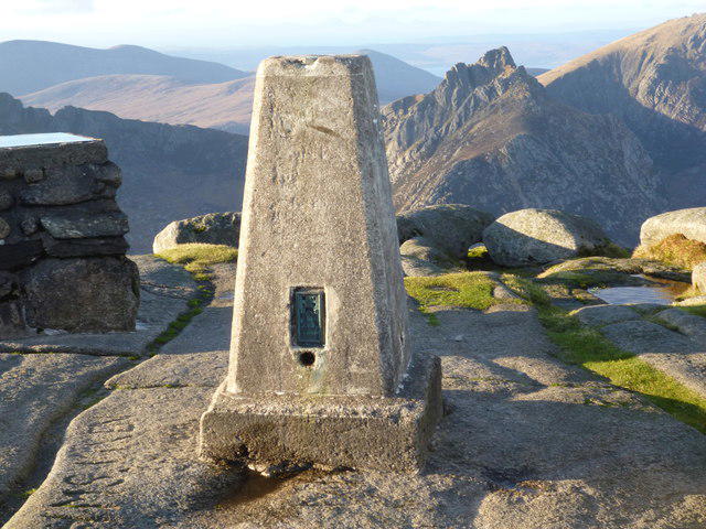 Photo could not load
NR9941 : Trig at Goatfell
Brian Robertson
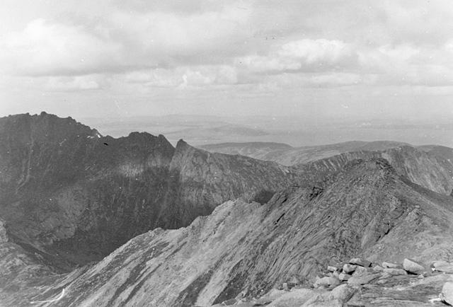 Photo could not load
NR9941 : View north from Goatfell
Nigel Brown
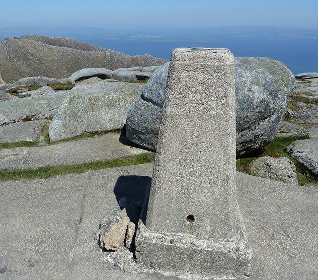 Photo could not load
NR9941 : Goatfell triangulation pillar
Rob Farrow
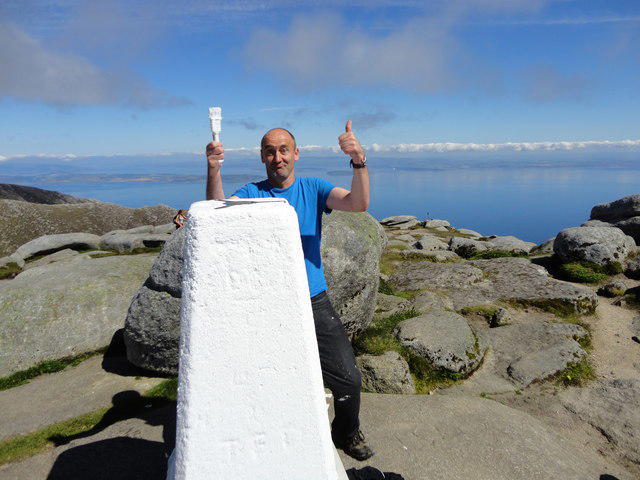 Photo could not load
NR9941 : Newly painted Trig Point on Goat Fell
Brian Robertson
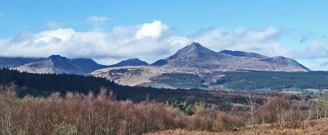 Photo could not load
NR9941 : Mountains of Northern Arran from viewpoint off A841
Rob Farrow
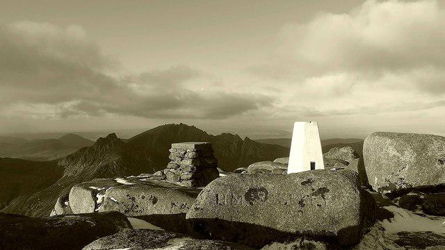 Photo could not load
NR9941 : Goatfell summit
Raibeart MacAoidh
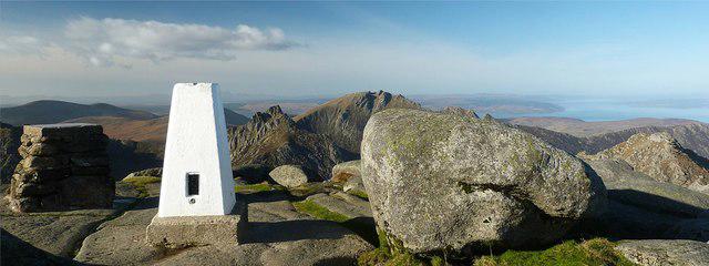 Photo could not load
NR9941 : Goatfell trig point
Raibeart MacAoidh
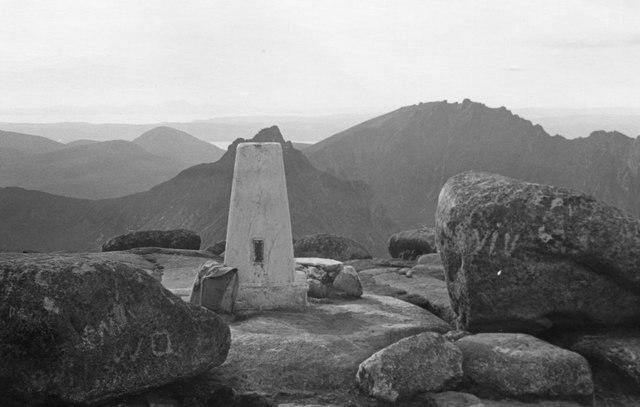 Photo could not load
NR9941 : Goatfell summit, 1973
Jim Barton
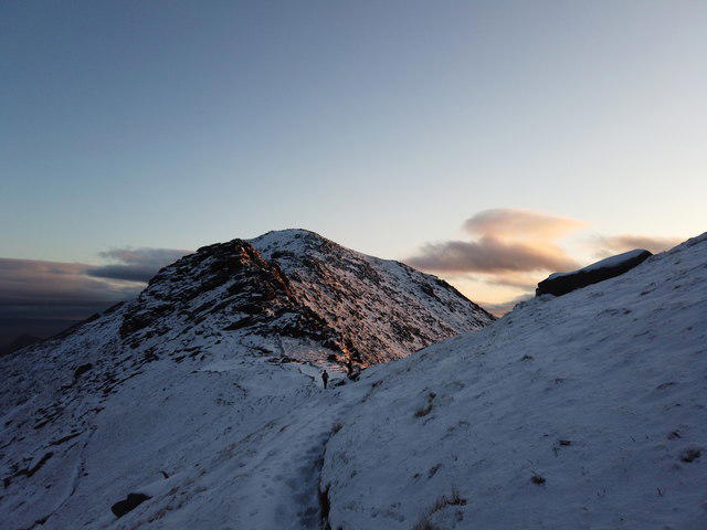 Photo could not load
NR9941 : Late evening view of Goatfell
Richard Murchie
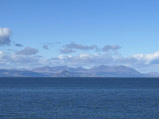
NR9941 : Isle of Arran and Goat Fell
Luath
Hill facts and local notes
Classifications
Elevation
875m
2,871 ft
Prominence
875m
Coordinates
55.6258, -5.1919
NR991415
OS Map
62 69
Explorer: 361N
At the Summit
The high point is a very large boulder about 3m northeast of the trig point. There is also a summit view indicator.
Terrain & Geology
Goatfell forms part of northern Arran’s granite massif. The granite intruded about 60 million years ago; later glaciation shaped the corries, ridges and U-shaped Glen Rosa.
Views & Scenery
Views across Arran’s granite ridges and the Firth of Clyde; in clear conditions, Jura, the Mull of Kintyre and the Northern Irish coast can be visible.
History & Heritage
Name Origin
Place-name researcher Jake King gives a likely Old Norse origin, Gait-fjall, meaning goat fell. The Gaelic form is Gaoitbheinn.
Historical Significance
Alasdair Gray’s 1965 painting Bay looks towards Brodick from Goatfell’s slopes. An Arran Arts Heritage Trail marker on the lower path commemorates the writer and artist.
Getting There & Facilities
Parking
For the standard route use Cladach by the A841, near the Wineport Bistro (NS012376). NTS lists parking on the landward side by the Bistro and the seaward side near the Arran Mountain Rescue base; keep its access clear. Brodick Castle car park has connecting paths.
Public Transport
Brodick is the ferry gateway to Arran. Local buses serve Cladach for the standard ascent and Corrie for the northern circuit. Check current ferry and bus timetables, especially the return connection.
Nearby Facilities
Toilets, including accessible toilets, are at Brodick Country Park. Refreshments are available around Cladach and Brodick; check opening times. NTS asks that dogs are kept on a lead on the Goatfell walk.
Safety Information
Known Hazards
- Steep, uneven granite steps and boulders, particularly on the final ascent and descent.
- Wrong turns west from the summit can lead into the dangerous Watershoot gully above Glen Rosa.
- The north ridge and North Goatfell involve scrambling, exposure and careful route-finding; harder rock steps have bypasses.
- Rapid weather changes and poor visibility can obscure the route. The Corrie Burn crossing may be difficult in spate.
Seasonal Hazards
Snow and ice can conceal the path and require winter mountaineering equipment and skills, including an ice axe and crampons when conditions demand. Short daylight and cold increase the consequences of delays.
General Safety Tips
- Check weather conditions before setting out
- Carry appropriate clothing and equipment
- Let someone know your planned route
- Take a map, compass, and GPS device
- Carry emergency supplies: food, water, first aid kit, torch
Hills
Some common questions about the hills answered
Are there group walks up Goatfell [Goat Fell]?
Many walkers use Walkmates to join or organise walks with others. You can check for group walks around Goatfell [Goat Fell] through the maps
Are there other walkers around Goatfell [Goat Fell]?
Activity varies by location and time, but Walkmates lets you see whether others have shared walks or shown interest in this area. Find other people through the walking friends search walking friends for Goatfell [Goat Fell] search or of course create your own walk for Goatfell [Goat Fell]
Can I organise a walk to Goatfell [Goat Fell]?
Yes. If there aren’t any walks listed already, you can create a walk and make it available for others to join.
If you're signed up to Walkmates, you can create a walk to Goatfell [Goat Fell].
How do I find a walk up this hill?
There are often multiple ways to walk this hill, depending on experience and route preference. Walkmates helps you explore walks and routes that others have shared.
Can I suggest a new route up Goatfell [Goat Fell]?
Yes. You can suggest or create routes to share with others. Walkmates focuses on the social side of walking, so routes are used to help people organise walks and explore areas together, rather than as detailed navigation tools or route libraries.
Other uses really appreciate knowledgeable walkers sharing their routes. Share your favourite route to Goatfell [Goat Fell] here
The is an error or something incorrect about this hill. How do I let you know?
We always strive to keep the information on Walkmates as accurate as possible. If you find an error, please let us know through the contact form and we'll aim to correct it as quickly as possible
Community Discussion
Comments
Location
![Goatfell [Goat Fell] location map](https://cdn.walkmates.com/hill-maps/hill-sources/1472/55.62584_-5.19188.png)
Grid reference: NR991415
View on OpenStreetMapOpens a map in a new tab, centred on the hill.
![The Cobbler [Ben Arthur]](https://cdn.walkmates.com/gallery-images/a1b697040769474a8338b3fb586ebc7a.jpg)
No comments yet. Be the first.